Stopped, at the edge of the sea
——Inō Tadataka's first survey: eight days, and a party of six — master and servants
Inō Tadataka (伊能忠敬, 1745–1818). A merchant of Sawara in Shimōsa province, he was permitted to retire at fifty-one and became the student of Takahashi Yoshitoki of the shogunate's tenmonkata — a man nineteen years younger than he was. He studied for five years, and at fifty-six he began to walk. On the nineteenth day of the intercalary fourth month of 1800 (Kansei 12) he left Fukagawa for Ezo. This was the first survey.
The purpose was a map, and one thing more — how many ri of ground you walk before the latitude changes by one degree. Know that, and multiplying by three hundred and sixty gives the length of one circuit of the earth. The distance walked, and the height of the stars measured at night. Those are the two numbers written in the diary, every day.
This page is a place to retrace, with verifiable facts, what the film could not tell.
① From quitting at fifty-one to walking out at fifty-six — a chronology
The key is as given in ④. 🟢 = confirmed in more than one source / 🟡 = differs between sources, or is taken at second hand.
- 🟢 Confirmed 1745 (Enkyō 2), born. He later took over a sake brewery at Sawara in Shimōsa province (now Katori, Chiba Prefecture) and lived as a merchant.
- 🟢 Confirmed The ninth month of 1763 (Hōreki 13), a solar eclipse occurred that was not in the shogunate's calendar. Several amateurs had predicted a partial eclipse of four bu or more. The following year's 『明和四年暦』 — the calendar for Meiwa 4 — carried an excuse concerning it.
⚠️This "four bu" is 食分, the depth of the eclipse. It is a different thing from the "seven fun" (a measure of time) that appears below (④-4). - 🟡 Disputed 1792 (Kansei 4), Laxman arrives at Nemuro. From then the shogunate moved to bring Ezo under its direct rule, established the Hakodate magistracy, and had Kondō Jūzō (近藤重蔵) inspect the island of Etorofu🟢 Confirmed.
- 🟢 Confirmed 1795 (Kansei 7), Takahashi Yoshitoki goes from Osaka to Edo. In the third month he is ordered to Edo; in the fourth he is made an assistant on survey duty; in the eleventh he is raised to the tenmonkata; the next year he is put on calendar-reform duty. This was because there was no one in the shogunate's tenmonkata who could carry out a calendar reform.
In the same year Tadataka was permitted to retire at fifty-one, and became Yoshitoki's student🟢 Confirmed. Tadataka is said to have gone to Edo in the fifth month of that year, so the two men's arrivals overlap in time🟡 Disputed (④-2). - 🟢 Confirmed 1797 (Kansei 9), the calendar reform is proclaimed. From the following year, 1798 (Kansei 10), the Kansei calendar came into use.
- 🟡 Disputed The seventh month of 1798 (Kansei 10), Kondō Jūzō sets up a wooden post on Etorofu reading 「大日本恵登呂府」 — Etorofu of Great Japan.
- 🟢 Confirmed 23 November 1798 (the sixteenth day of the tenth month of Kansei 10), a partial lunar eclipse. The observation ran about seven minutes later in time than the Kansei calendar's prediction. In a letter dated the second day of the eleventh month of that year Yoshitoki wrote 「時刻は推歩余程の後れ〜半刻計の遅れ」 — the observed time ran a good deal behind the computation, a delay of about half a koku — and 「後編月離も未尽さる」, that the accuracy of the Kansei calendar was itself not yet sufficient.
- 🟡 Disputed 1799 (Kansei 11), the provisional transfer of eastern Ezo to direct shogunal control is carried through.
- 🟢 Confirmed The nineteenth day of the intercalary fourth month of 1800 (Kansei 12), departure from Fukagawa. Six persons, high and low; light rain from the morning. They stopped at the observatory in Asakusa, and were given sake by Takahashi-sensei (②).
- 🟢 Confirmed The sixth day of the fifth month, the post station of 三ノ戸. That day's entry contains 「山邊源兵衛と歸府の節の止宿を約す」 (⑤).
- 🟢 Confirmed The eleventh day of the fifth month, 「此日東風ヤマセ風と云 ニ而渡海ならず」. From then, the party stays held up at Minmaya🟡 Disputed. The crossing came on the nineteenth day of the fifth month, in an official ship of the Tsugaru domain. Where they came ashore was not Hakodate, which they had been aiming for, but Yoshioka (吉岡), in what is now the town of Fukushima, Hokkaido.
- 🟢 Confirmed The twenty-first day of the tenth month, arrival in Edo. The journey that set out — six of them, master and servants — in light rain on the nineteenth of the intercalary fourth month closes here.
⚠️On this page we do not count the number of days. Because it is not written in the original (④-12). - 🟢 Confirmed From 1800 to 1816 (Bunka 13), over seventeen years and ten expeditions in all, he led the survey parties and carried out a survey of the whole country.
- 🟡 Disputed 1804 (Bunka 1), Yoshitoki dies. His eldest son Takahashi Kagayasu succeeded to the tenmonkata at twenty, supervised Tadataka's survey, and supported it fully.
- 🟢 Confirmed 1818 (Bunsei 1), Tadataka dies. 『大日本沿海輿地全図』, the complete map of the coasts of Japan, was presented to the shogunate in Bunsei 4 (1821) — the third year after his death.
- 🟡 Disputed 1828 (Bunsei 11), it came to light that Kagayasu had given the Inō maps, a prohibited item, to a foreigner who had come to Japan; he was arrested, and died in prison in the third month of the following year.
What the tenmonkata was — the shogunate's bureau of sky and calendar →
② The eight days at Minmaya
The party pressed north along the Ōshū Kaidō. According to the diary, on the ninth day of the fifth month they left Aomori for Yomogita. They are said to have reached Minmaya (三厩), at the northern end of Honshū, on the tenth day of the fifth month🟡 Disputed. From here they were to cross the Tsugaru Strait by boat. The entry for the eleventh day of the fifth month reads:
此日東風ヤマセ風と云 ニ而渡海ならず This day an east wind, which they call the yamase wind — and so, no crossing.
Source = 『蝦夷于役志』 (a record of service in Ezo), the entry for the eleventh day of the fifth month of Kansei 12. In 「伊能忠敬測量日記抄」, contained in 『青森県立図書館叢書』 vol. 4, ed. Aomori Prefectural Library (Aomori Prefectural Library, Shōwa 8 / 1933) = National Diet Library Digital Collections (published on the internet; copyright term expired). The transcription is our own, made by eye from the images.
A wind blowing from the east is called, in this place, the "yamase wind." The word of the place is written down just as it was said.
And the next day, and the day after that, the same thing is written. From their arrival at Minmaya to the crossing, set out from the itinerary🟡 Disputed.
| Fifth month | That day's entry (rendered; the original below) |
|---|---|
| 10th | Arrived at Minmaya (lodging = 工藤忠兵衛)三厩 着(宿=工藤忠兵衛) |
| 11th | East wind (the yamase); no crossing東風(ヤマセ風)にて渡海ならず |
| 12th | East wind; no crossing, stayed on東風にて渡海ならず逗留 |
| 13th | East wind; no crossing, stayed on東風にて渡海ならず逗留 |
| 14th | No wind; no crossing, stayed on無風にて渡海ならず逗留 |
| 15th | East wind; no crossing, stayed on東風にて渡海ならず逗留 |
| 16th | East wind; no crossing, stayed on東風にて渡海ならず逗留 |
| 17th | Set out to cross; the wind died; back to Minmaya渡海の所風止み又三厩へ帰る |
| 18th | East wind; no crossing, stayed on東風にて渡海ならず逗留 |
| 19th | Crossed, in a ship of the lord of Tsugaru津軽候の御船にて渡海 |
Source = the itinerary of the first survey published on the site run by the Inō Tadataka research society (伊能忠敬研究会). ⚠️The 『測量日記抄』 readable at the National Diet Library is a 抄 — a set of selections — and the entries from the twelfth day onward could not be confirmed from it. We treat the confidence of this table as 🟡.
On the fourteenth, with no wind at all, they did not cross.
無風にて渡海ならず逗留 No wind; no crossing; stayed on.
Source = as above (the itinerary; confidence 🟡).
On the seventeenth they did put the boat out. And then —
渡海の所風止み又三厩へ帰る Set out to cross; the wind died; returned again to Minmaya.
Source = as above (the itinerary; confidence 🟡).
They went out, the wind stopped, and they came back to Minmaya. When the wind blew they could not cross. When the wind stopped they could not cross. A man who had set out to measure the size of the earth on foot was stopped at the edge of the sea.
The days they couldn't cross are written down too, aren't they. …If he had only written the days he got somewhere, those eight days would have been as though they never were.
The crossing came on the nineteenth day of the fifth month, in an official ship of the Tsugaru domain. But the place they landed was not where they had meant to go. They were aiming for Hakodate. The wind carried the ship to Yoshioka (吉岡), in what is now the town of Fukushima, Hokkaido🟢 Confirmed. From there the party tried to go on to Hakodate by boat, and waited until about ten the next morning for the wind to change; when it did not, they decided to go on overland, surveying as they went. The survey of Ezo began from a place they had not meant to go to.
⚠️The same source states that in a letter Tadataka sent to his eldest son the landing place is recorded as 「吉岡と申す川岸」, a river bank called Yoshioka. But we have not been able to consult the letter itself; as this is taken at second hand, the confidence is 🟡.
③ "Six, high and low" — the names are all written down
Let us quote the entry for the day of departure at a little more length.
○閏四月十九日、朝五ツ前深川出立、上下六人、伊能勘解由、門倉隼太、平山宗平、伊能秀藏、夫より下人佐原吉助、新に名か〔?〕へ候長助なり、此日朝より小雨、晝後に止、深川八幡宮参詣、荷物は深川より直に千住宿へ積送……両國通り淺草司天臺へ立寄、高橋先生に而御酒を給 On the nineteenth day of the intercalary fourth month, set out from Fukagawa before the hour of five in the morning; six persons, high and low — 伊能勘解由, 門倉隼太, 平山宗平, 伊能秀藏, and below them the servants 佐原吉助 and 長助, whose name had newly been changed〔?〕. Light rain from the morning this day, stopping after noon. Paid a visit to the Fukagawa Hachimangū. The baggage was sent on directly from Fukagawa to the Senju post station …… passing by way of Ryōgoku, stopped at the Asakusa observatory, and was given sake by Takahashi-sensei.
Source = 『蝦夷于役志』, the entry for the nineteenth day of the intercalary fourth month of Kansei 12 (as above; National Diet Library Digital Collections / copyright term expired). "……" marks an omission. What stands inside 〔 〕 is illegible, or a note by the editor, and is not Tadataka's own writing. The transcription is our own, made by eye from the images.
The six who left Fukagawa
上 high伊能勘解由 門倉隼太 平山宗平 伊能秀藏
下 low佐原吉助 長助
「上下」 means high and low in rank. Four above — and among them, 伊能勘解由 is Tadataka's own common name. Then, past the line the original draws with 「夫より下人」 ("and below them, the servants"), two more🟡 Disputed. Six in all.
⚠️The readings of the names are not recorded in the sources, and we could not confirm them. Nor could we obtain dictionary backing for the expression 「上下◯人」 itself (this is a reading taken from the structure of the original). In the passage for 長助 — 「新に名か〔?〕へ候長助なり」 — we have not been able to make out one or two characters from the image.
And these six crossed the sea just as they were. The Fukushima Town Board of Education writes: 「伊能忠敬測量隊6人を乗せた船が吉岡川に到着しました」 — the boat carrying the six of Inō Tadataka's survey party arrived at the Yoshioka river🟢 Confirmed.
The diary also lists the names of the people who gave them sake and food on the day of departure, and who shared a parting meal at the Senju post station — 小網町伊勢屋三米三郎, 支配人鯉屋庄兵衞, 堺屋源八, 神田時計師彌五郎, 彌三郎, 天満屋八右衛門, 綿屋富右衛門, 佐原柏屋幸右衛門…. According to research, the names recorded across the seventeen years of the diary, as collaborators who took part in the work or provided lodging, come to twelve thousand🟢 Confirmed. He was on the side that leaves names behind.
He had a cup before he went. …At the house of the man he had studied under for five years.
④ In more detail — differing accounts
The key: 🟢 = confirmed in more than one source / 🟡 = differs between sources, or is taken at second hand / ⚪️ = no backing obtained. Where we do not know, we write that we do not know.
🟢 Confirmedconfirmed in more than one source 🟡 Disputeddiffers between sources, or is taken at second hand ⚪️ Unverifiedno backing obtained
1. The age at which he retired is split between fifty and fifty-one 🟡 Disputed
The Agency for Cultural Affairs' designation commentary says 「寛政7年(1795)51歳にて隠居」 — retired in Kansei 7 (1795), at fifty-one. Another source, meanwhile, writes 「50歳の忠敬に対し、師匠の至時は31歳」 — Tadataka at fifty, his teacher Yoshitoki at thirty-one. This appears to be the difference between the traditional count of years and full years, but this page follows the Agency for Cultural Affairs' wording and does not decide which is correct. The difference in their ages — nineteen years — is the same in either source.
2. There are two accounts of what led him to become a student 🟡 Disputed
Account A (an intellectual motive) = Tadataka, having noticed that the old Chinese calendar 『授時暦』 did not agree with the actual phenomena of the sky, asked the scholars of Edo why; none of them could answer, and the only one who could was Yoshitoki. He then pleaded desperately with Yoshitoki until he was allowed to enter as a student — so it is told.
Account B (he had the information) = the moves toward the calendar reform were being made in secret, but 桑原隆朝, the father of Tadataka's third wife Nobu, had strong ties with 堀田正敦, the shogunal official who was pushing the reform through. So it is also thought that Tadataka knew in advance that the two men would be coming to Edo — that is the account.
These two do not contradict each other (he may well have had both an intellectual interest and the information). ⚠️Both are 「伝えられている」「考えられている」 — as it is told, as it is thought — neither is asserted.
3. Who was it who said "between Fukagawa and the calendar office is too close"? ⚪️ Unverified
The story that Tadataka first tried it out inside Edo — that he paced out the distance between his house in Fukagawa and the calendar office in Asakusa (a difference of one and a half minutes of latitude) — and his teacher's reply to it, have as their only source the site run by the Inō Tadataka research society. And that site itself writes in the language of conjecture: 「歩測して……提出したらしい」 ("he seems to have paced it out and submitted it"), 「……というようなことを述べたのであろう」 ("he probably said something to that effect"). We could not obtain it from the materials of any public institution.
This page leaves it as it is, conjecture and all. We do not straighten it into an assertion.
⚠️For reference, in today's way of measuring, one minute of latitude is about 1.85 kilometres, so one and a half minutes is about 2.8 kilometres. A walkable distance. It is not a value Tadataka knew.
4. There are three different 分 in this story 🟢 Confirmed
① the 分 of time (seven 分 later than the prediction; read fun) / ② the 分 of angle (one and a half 分 of latitude; read fun) / ③ 食分 (the depth of an eclipse; an eclipse of four 分 or more; read bu). Mix them and the meaning changes.
Note also that the expression used at the time was 「半刻」, half a koku. Yoshitoki's letter says 「半刻計の遅れ」, a delay of about half a koku, and the National Astronomical Observatory of Japan converts that to "about seven minutes."
5. Was the "seven minutes" a large discrepancy? 🟢 Confirmed
The National Astronomical Observatory of Japan states that, from this observation, 「寛政暦の月の位置精度は時間にして10分弱、角度にして0.1°弱程度と推定できます」 — the accuracy of the Kansei calendar's lunar positions can be estimated at a little under 10 minutes in time, and a little under 0.1° in angle. Seven minutes was within what this calendar could do. The same source also writes 「それまでの暦に比べればずっと精密な予測ではあるものの」 — that it was a far more precise prediction than the calendars before it. The calendar was not broken.
A table of the measured values survives as well.
| Observed | Kansei calendar | Modern value | |
|---|---|---|---|
| First contact | 20:31:12 | 20:21:33 | 20:29:51 |
| Maximum | 21:56:53 | 21:50:41 | 21:57:26 |
| Last contact | 23:22:25 | 23:19:41 | 23:25:06 |
Source = National Astronomical Observatory of Japan, calendar computation office (暦計算室) — the partial lunar eclipse of the sixteenth day of the tenth month of Kansei 10 = 23 November 1798.
And still, the man who had made this calendar was not satisfied with it.
6. Whether private astronomers predicted the lunar eclipse of 1798 is not known ⚪️ Unverified
For the lunar eclipse of 1798, we found no description touching on predictions by private or unofficial astronomers. What we do have is for the solar eclipse of 1763 — 「一方で、地方の暦算家たちが四分以上の食を予測していました」, "meanwhile, calendar-calculators in the provinces had predicted an eclipse of four bu or more"🟢 Confirmed. That is a story from thirty-five years earlier. We cannot say that 1798 was the same.
7. We do not use any figure for the accuracy ⚪️ Unverified
Several numbers are in circulation regarding the accuracy of the Inō maps. But there is no such figure in the materials of the Geospatial Information Authority of Japan, nor in the research papers, nor in the Agency for Cultural Affairs' commentary. Trace them back and you arrive at sites and blogs that give no source. This page gives no figures. Nor do we use expressions such as 「驚くべき精度」, "astonishing accuracy" (an adjective without backing does the same work as a number).
8. The subject of "he wanted to measure the size of the earth" shifts between sources 🟢 Confirmed
The materials of the Geospatial Information Authority of Japan put it this way — 「忠敬の師匠の高橋至時は、地図作りをしながら同時に各地の緯度を調べ、緯度1度の距離を算定しようと考え、蝦夷地までの測量と地図作りを幕府に願い出ました。その担当者として推薦したのが弟子の忠敬で」: Tadataka's teacher Takahashi Yoshitoki thought to investigate the latitude of each place while making maps, and so to calculate the distance of one degree of latitude, and petitioned the shogunate for a survey and mapping as far as Ezo; the one he recommended to carry it out was his student Tadataka.
That is, the one who petitioned was the teacher, and Tadataka was recommended as the one to carry it out. Within the same Geospatial Information Authority, the page for children says 「地球の正しい大きさを知るために……測量に出かけました」 — "he set out to survey … in order to know the true size of the earth"🟡 Disputed — and the wording wavers. This page follows the more precise of the two.
The same source also sets the shogunate's own circumstances down beside it — 「おりしも、蝦夷地近海にロシア船がたびたび来航するようになり、幕府は国防のために正確な地図が必要と考えていました」: just at that time, Russian ships began coming often to the seas off Ezo, and the shogunate considered that it needed accurate maps for national defence. 「おりしも」 — "just at that time" — means that the two motives are set side by side, not as cause and effect.
9. The diary comes down in two lines 🟢 Confirmed
"Two kinds of Inō Tadataka's diary survive: 『伊能忠敬先生日記』 in 51 volumes, written up day by day in the field, and 『測量日記』 in 28 volumes, later made into a fair copy from them" (鈴木純子, 2020). What has been known and read in the world is the fair copy. The paper written on while walking survives separately, under a different name.
10. When the title 「測量日記」 was given could not be confirmed ⚪️ Unverified
There is an account that it was "added at the time of the rebinding repair of Shōwa 27 (1952)." If it were true it would make a strong line, but it appears in none of them — the Agency for Cultural Affairs' database, the catalogue PDF of the city of Katori, or the research paper (19 pages, checked into the body text) — and the only place the wording was found was a single private site with no source given. We do not write it.
11. Images of the diary's pages were not within what is publicly available 🟢 Confirmed
Among the twenty-six images the Inō Tadataka Memorial Museum provides free of charge, 『測量日記』 is not included (confirmed by going through the list page and every individual page). Nor did we find page images at the National Diet Library, the National Archives of Japan, university repositories, or ColBase.
That we could quote the diary verbatim on this page and in the film is thanks to 『伊能忠敬測量日記抄』, set in type by the Aomori Prefectural Library in 1933 (Shōwa 8). ⚠️This is a 抄 — a set of selections; only parts of the diary were set in type.
12. We do not count the days 🟢 Confirmed
He set out on the nineteenth of the intercalary fourth month, and arrived back on the twenty-first of the tenth month. That is what the original writes, and nothing further. At the end of the second survey in the same book there is a line where he counted the days himself — 「黒江町ゟ歸る、出立日より二百四十二日」, returned from 黒江町; two hundred and forty-two days from the day of departure. But for the first survey, no count of days appears in this edition. So we do not count here either — because that would be arithmetic, and not the words of the diary.
13. The observatory Hokusai drew 🟡 Disputed
In 「鳥越の不二」, Fuji at Torigoe, from Katsushika Hokusai's 『富嶽百景』 (One Hundred Views of Mount Fuji), the observatory at Asakusa is drawn. It is the place Tadataka stopped at on the day he set out. However, it has been pointed out that the armillary sphere drawn there may be a composition of Hokusai's own imagining (Henry D. Smith II). It is an observatory drawn by an artist, not a picture taken from observation. ⚠️It is 『富嶽百景』, not 『富嶽三十六景』.
⑤ The real things are still there — from the shelves
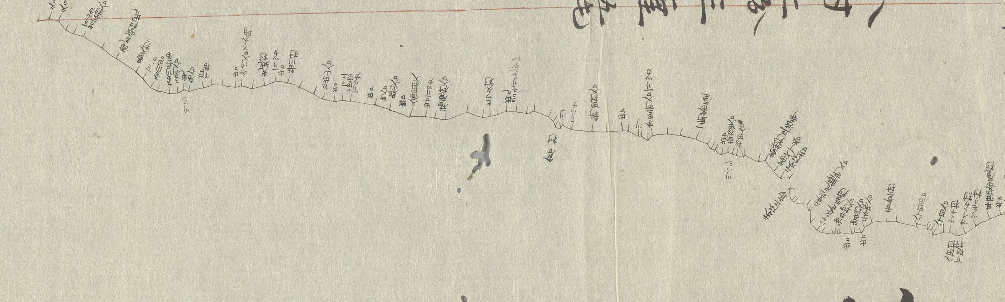
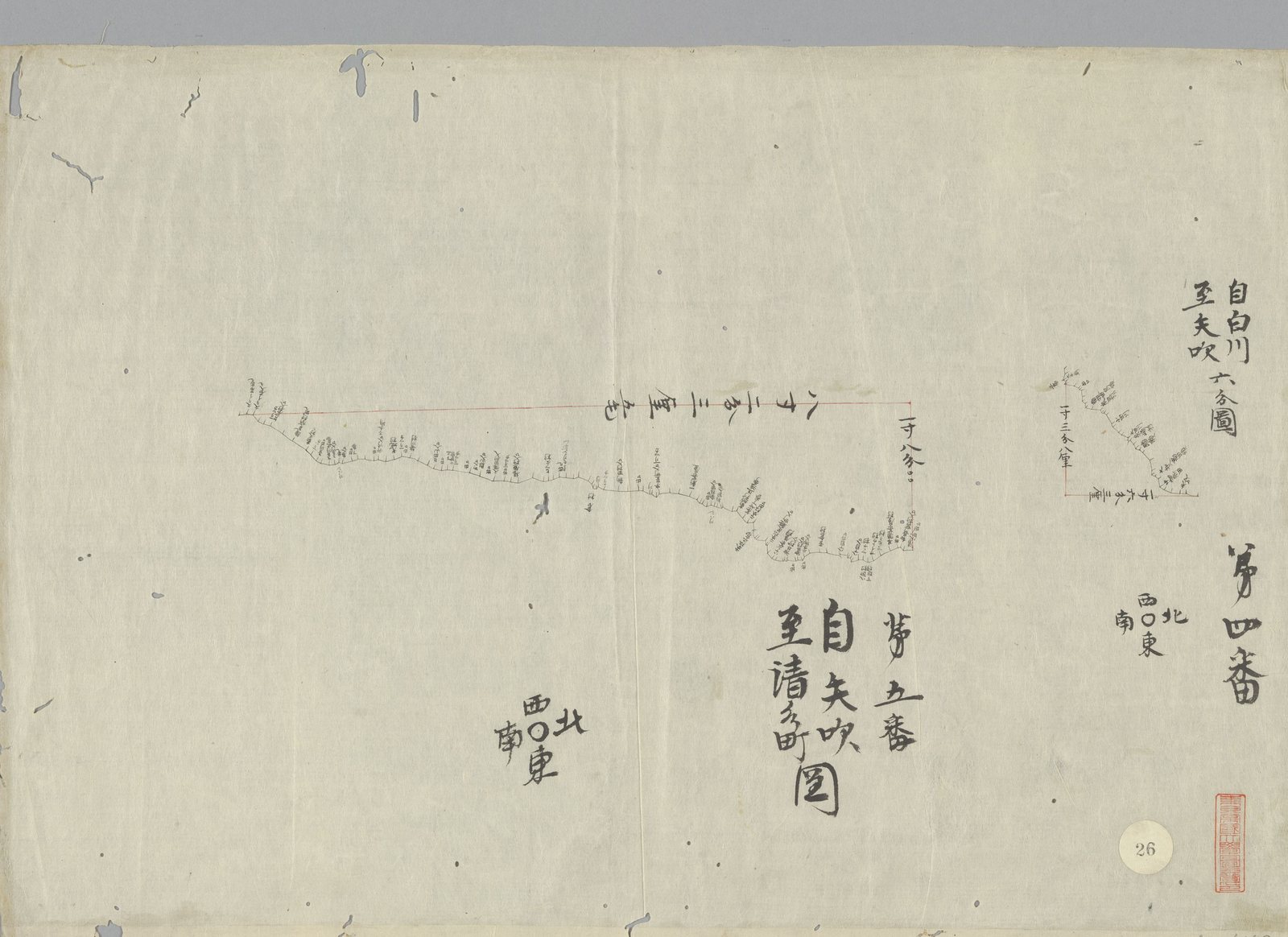
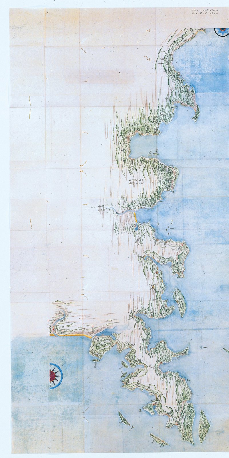
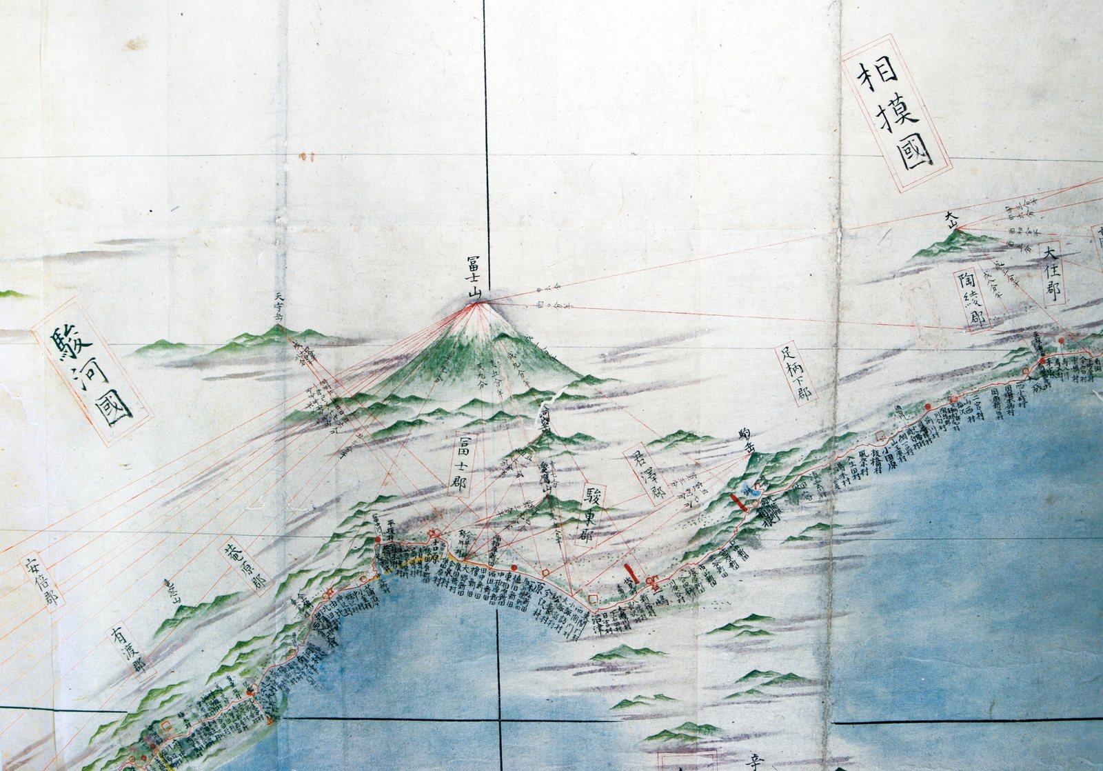
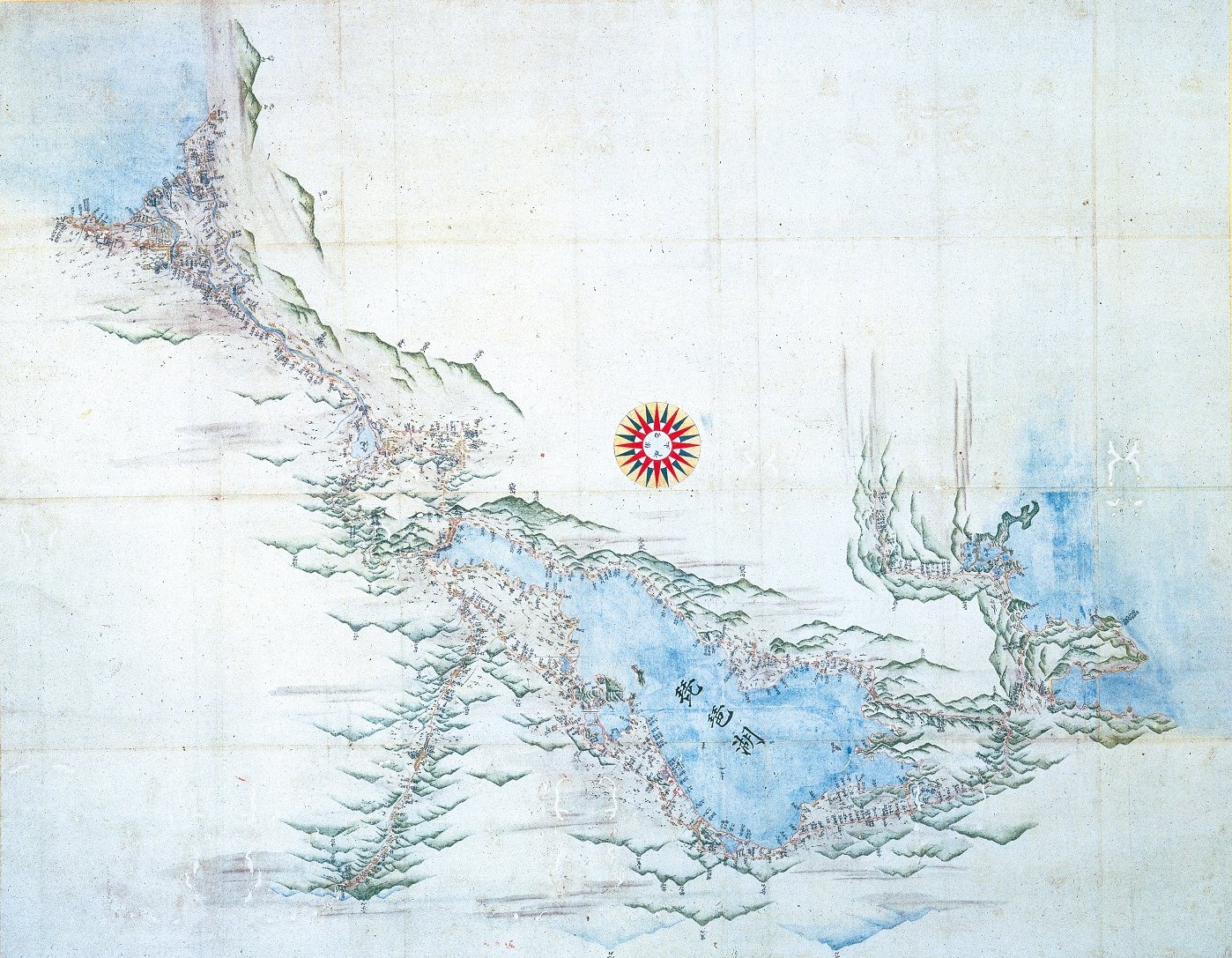
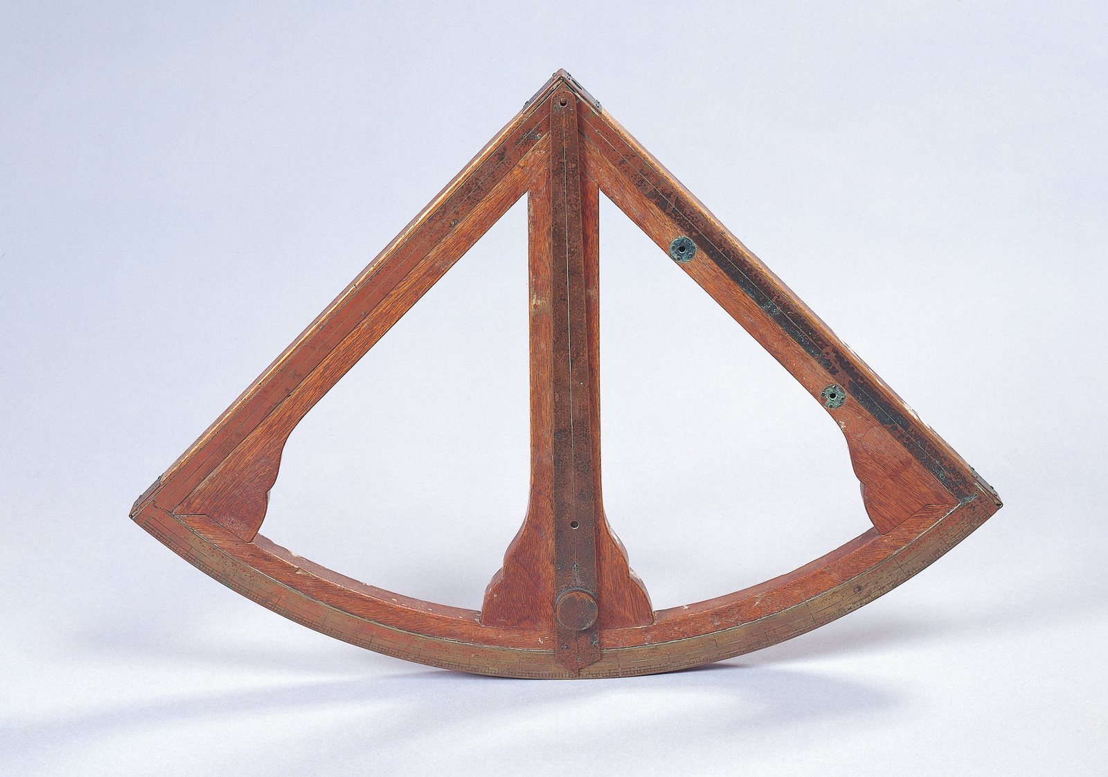
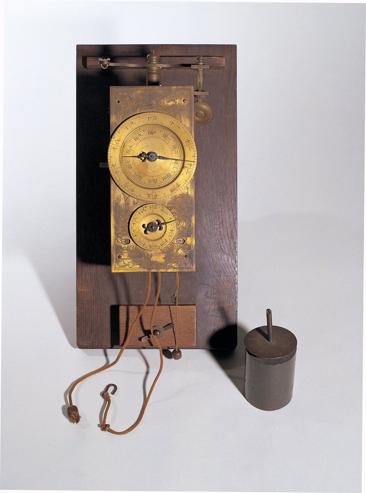
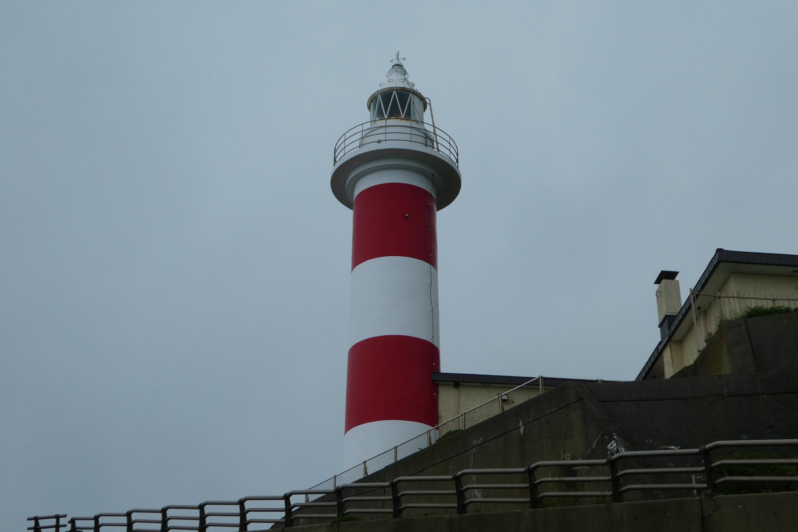
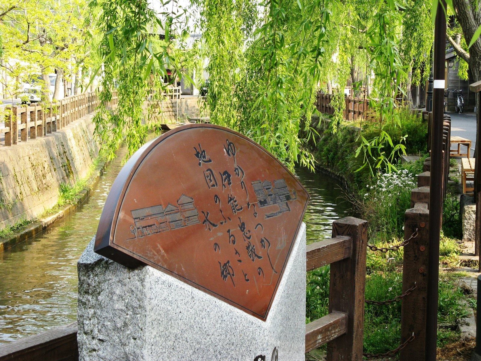
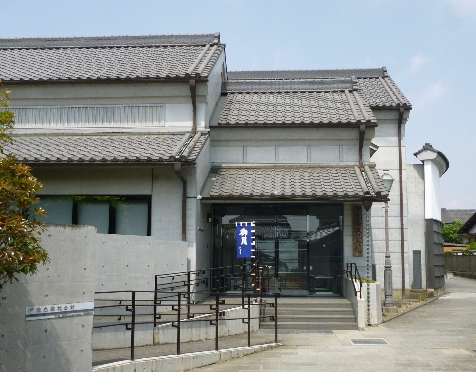
What Tadataka left survives as the National Treasure 「伊能忠敬関係資料」, the materials relating to Inō Tadataka — 2,345 items — and is still in Katori, Chiba Prefecture (maps and drawings 787 / documents and records 569 / letters 398 / books 528 / instruments 63). Set out here are the drawings and instruments that would not fit on the screen of the film, together with photographs of the same places as they are now. The sources are as given in each caption.
⑥ One last thing
On the sixth day of the journey, the sixth day of the fifth month. The party lodged at the post station of 三ノ戸 (now the town of Sannohe, Aomori Prefecture). In the middle of that day's entry, one line runs like this.
山邊源兵衛と歸府の節の止宿を約す Agreed with 山邊源兵衛 on lodging for the time of the return to Edo.
Source = 『蝦夷于役志』, the entry for the sixth day of the fifth month of Kansei 12 (as above; National Diet Library Digital Collections / copyright term expired). The transcription is our own, made by eye from the images.
On the way back, we will stay here too — on the road out, he made a promise about the lodging for the way home. Which is to say that a fifty-six-year-old on his way to Ezo was walking on the assumption that he would come back.
The diary closes with 「十月廿一日江戸着」, arrived in Edo on the twenty-first day of the tenth month. The return route passes through 三ノ戸 as well, but whether that promise was kept is not written anywhere within what we were able to read. The name 山邊源兵衛 does not appear in the entries for the return.
⚠️This does not mean that he did not stay there. We stop at: it could not be confirmed.
⑦ In closing
What is written in the diary is the weather of the day, the lodging they stayed at, the distance walked, and the height of the stars measured at night. The distance walked, and the height of the stars — the two numbers needed to arrive at the size of the earth are, just as they are, the daily record. And so the days on which he got nowhere are written in the same manner. An east wind and no crossing, no wind and still no crossing, and even the day they went out and turned back — all of it set down in the same dry words. And in among them are the names of the six who set out, and a promise made with the master of an inn. The work of measuring on foot survived as this kind of paper. The road walked on the first survey becomes the line of the small-scale survey map of Kansei 12 (寛政十二年測量小図). Beneath that line are the eight days they could not cross.
⑧ About this page
This film and this page are made on the basis of information published by public institutions (the Agency for Cultural Affairs' database, the Geospatial Information Authority of Japan, the calendar computation office of the National Astronomical Observatory of Japan, the National Diet Library, the National Archives of Japan, the city of Katori / the Inō Tadataka Memorial Museum, and publications of the Fukushima Town Board of Education) and research published in academic journals. The copyright term on Tadataka's own writing has expired🟢 Confirmed. The verbatim passages are our own transcription, made by eye from images of a 1933 printed edition whose copyright term has expired (『伊能忠敬測量日記抄』). ⚠️Page images of 『測量日記』 itself were not found within what is publicly available. That is why the quotations in this episode carry no photograph of the paper. Views on the language are welcome.
Sources
Agency for Cultural Affairs, database of nationally designated cultural properties / Cultural Heritage Online, the National Treasure 「伊能忠敬関係資料」 / Geospatial Information Authority of Japan, 『"伊能図" 近代地図の原点 〜大日本沿海輿地全図完成二百年記念〜』 and "Survey and maps, brief lives: Takahashi Yoshitoki" / National Astronomical Observatory of Japan, calendar computation office, Koyomi Wiki (Takahashi Yoshitoki and the Kansei calendar; the accuracy of the Kansei calendar) and its exhibits / National Diet Library, "The calendars of Japan" / National Archives of Japan, digital exhibition 『激動幕末』 / 鈴木純子, "Academic exchange accompanying Inō Tadataka's survey work," Journal of Geography vol. 129 no. 2 (2020) / 中塚徹朗, "The first step of the map of Japan was from Yoshioka," in 『北海道ふくしま歴史物語』, published by the Fukushima Town Board of Education / the site run by the Inō Tadataka research society (the itinerary of the first survey; the account of the pacing-out = 🟡) / Japanese Wikipedia, "伊能忠敬," "高橋景保," "近藤重蔵," "伊能図" and others (🟡; taken up only after confirming that no "citation needed" note was attached).
Verbatim text = 『青森県立図書館叢書』 vol. 4, ed. Aomori Prefectural Library, Aomori Prefectural Library, Shōwa 8 (1933). National Diet Library Digital Collections https://dl.ndl.go.jp/pid/1174042 (accessed 2026-07-28).
Images = held by the Inō Tadataka Memorial Museum, Katori, Chiba Prefecture (the National Treasure 「伊能忠敬関係資料」) / provided by the Inō Tadataka Memorial Museum, Katori, Chiba Prefecture (the museum exterior) / survey draft maps (held by the University of Tokyo Library) / Wikimedia Commons, as shown in each Creative Commons credit.
This channel does all source selection, fact verification, and interpretation and final judgment of language by human hands. Parts of production (voice synthesis, image stylization, translation assistance) use AI. See our production principles.
Watch the film / to the next piece
We go looking for the next piece of paper. Subscribing, and a thumbs-up on this film, are what make that possible.
Watch & subscribe on YouTube → The paper that could not be carried out (Yamamoto Hatao, #012) → Follow it on the map → The Kura (index) →
The facts in this article rest on information published by public institutions, on research published in academic journals, and on a printed edition whose copyright term has expired (the main sources are also in the video description). The images shown are public domain, or materials whose holding institutions permit their publication, or openly licensed photographs (see each credit).
Article text © 2026 紙片の日本史 / Fragments of Japan ・ Corrections of factual error: contact@fragmentsjapan.com